Switzerland of the North

Atlin is in beautiful British Colombia and referred to as the ‘Switzerland of the North’.  Simply a stunning place and one that wasn’t on our hit list until our new friend Ramona sang its praises over dinner one evening while in Alaska.  She said she’d move there if she could.  Now that’s a ringing endorsement.  After reworking the schedule yet again, we carved out three nights and would love to have stayed twice as long.

On The Way

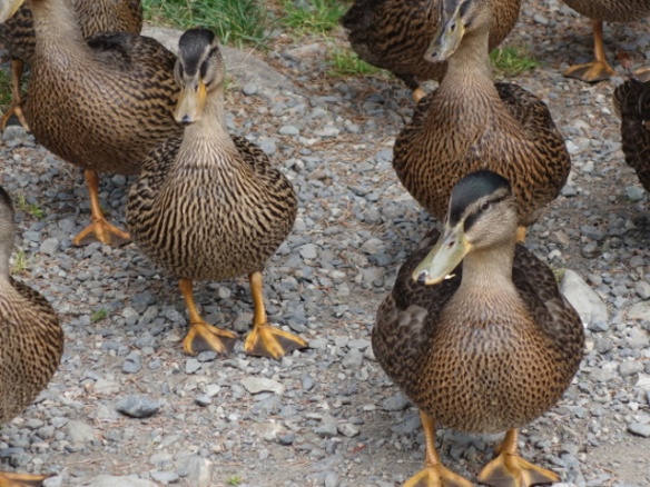
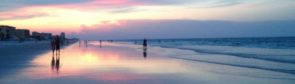
Only one road goes to Atlin and that’s out of the Yukon.  We were more than happy to make that 57 mile detour off the Alaska Highway and loved our lunch stop.  So pretty that we pulled out our chairs and sat for a while on the shore of Little Atlin Lake.  Peaceful and hardly anyone on that road at all.  We could hear the ducks across the water, the buzzing of the insects and the lapping lake water.

DSC00307DSC00308DSC00306

We figured we’d better get Poop in on the act, too, since he hadn’t been photographed in the Yukon.

DSC00305

I woke him up and he’s busily talking and sneezing.  And the Yukon was close to being his new home since we almost left him on that rock by accident.

Norseman Adventures RV Park

The campground in Atlin was a tad cozy shall we say, but you couldn’t beat the views.  Totally worth it and the close proximity helped us to meet our neighbors Jakob & Maggie from Atlanta, and a cute young couple in a rental van on a 3-week holiday from the Netherlands.

DSC00332

The park had these fun Norseman signs pointing the way through town.  Not that you could really get too lost.  It’s a small place with only 400 residents.  And as you can tell from the sign, they are pretty proud of the internet they provide.  That is so important in this town since there is absolutely no cell service of any kind.  Don’t care what kind of phone or plan you have.  No cell tower means no cell service.  Of course the internet had some strings.  Only available from 10-noon and 4-6pm,  (costs were through the roof you know) AND…

DSC00333

…you have to stand really close to this little outhouse-like building.  If another RV was between you and it, no go.  The pay phone does work.  When was the last time you saw one of those?

Now you’re wondering why this place is so great if communication is such an issue and the spaces are so close.  The view.

DSC00330

Our spot right on Atlin Lake.

DSC00335DSC00317

And the views out our front window.

Of course I cheated and took these outside the RV, but I have a very good reason…

DSC00310

This would have been a super shot of the little island in our beautiful view, but my very smart camera focused in on the bug splats instead of what I wanted.  I can’t tell you how many really swell shots you missed from this trip since I only ended up with windshield gunk and bug guts.

But I digress.  Even if this hadn’t been a drop-dead gorgeous spot, we had plenty of entertainment compliments of Atlin Air.  The pilot would fly in and out all day long taking supplies, picking up people, and flying sightseeing tours of the area.

We were able to watch take-offs and landings multiple times a day.  Seems like every time he went somewhere, all the campers stopped what they were doing to watch in rapt attention.  Also, the pilot is Swiss as were a few other campers, and our new friend Jakob.  Apparently this is a favorite vacation spot for Swiss visitors adding a little authenticity to that ‘Switzerland of the the North’ moniker.

Atlin Mountain

DSC00321

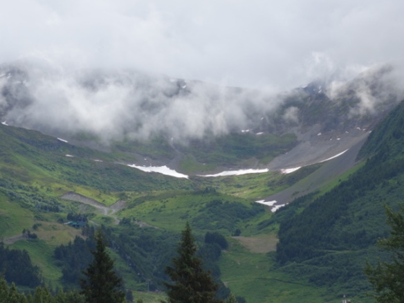
Atlin Mountain takes center stage in the view from town.  This mountain isn’t the tallest at 6,712 feet, or the most interesting in shape, but it is unique.  That slide looking area in the middle is actually a rock glacier.  The Atlin Claim Special Visitor’s Edition describes it this way: “Although not a real glacier, it behaves as a real glacier does; flowing, deforming and advancing into the forest areas at its toe.”  I’d never heard of such geology and it is something to see.  And that visitor’s edition paper we were given when we arrived?  From 2007!  It’s a little like going back in time here.

The mountain also sits on Atlin Lake, the largest natural one in BC.

DSC00318

We drove to a ridge just outside of town on another gravel road, and tramped to the microwave tower to get this view of the town and Atlin Lake.  That island isn’t as little as it looks from our RV window.  We’e decided that if we have lakefront like this, maybe we don’t need a riverwalk when we finally settle somehwhere.  Of course a lot of the appeal here is being off the beaten path with no highways and no crowds.

The Town

Atlin had all we needed.  A place to park Lucy, a laundromat, art gallery/gift shop, and the Pine Tree Restaurant.  I did some laundry and browsed the gift shop while I waited.  Dinner at the Pine Tree was a special treat.  The owners were having their “grand opening” since buying it from the previous owner.  Turns out they were giving away prizes to lucky diners as part of the celebration.

I won a huge gift basket, proudly presented by the owner over dinner.  They took my picture for their bulletin board, and the chef even came out to see who won since he randomly picks the winning “plate”.  Of course I wasn’t the only winner.  Vonnie won a cupcake tower and shared with all the rest of us.  Her story is so interesting.  She and her partner Jim have a gold claim just outside of town and are really working it.  He’s a geologist and figures out the best locations to dig.  Her gold mining career started after she came out on vacation to cook temporarily for the miners while visiting Jim.  And just like that she was hooked.  No administrative job in the city for her any longer.

DSC00336

Atlin also boasts one of the old boats similar to the sternwheeler we saw in Whitehorse.  The Tarahne was a cargo and passenger boat before Atlin had road access.  After the road connection in 1949 it was put out to pasture.  On the hill in the background, you can see the tower where we took the town overlook photo.

Out and About

We had to get Jackson in on the act, so we took a drive to the “beach” just outside of town.

Nothing like some good off-leash stick fetching.

We also read that the road to Surprise Lake would be closed for a few days so figured we’d better head there to see it.  Another adventure down a longer gravel road.

DSC00324

Surprise!

More stick fetching to be done.  But off leash dog tried to sneak off.  Good thing he tires easily these days and doesn’t want to be left behind.  I start up the car and pretend to drive and he comes running.

DSC00339

We did a little exploring without Jackson and went to Warm Bay.  Another gravel road adventure.  It was so quiet you could hear the trees creaking in the wind.

I was determined to find The Grotto at the end of the road.  We got to the sign that said the road was no longer maintained, which I’m guessing means an even rougher gravel road.  Since I hadn’t found anything that looked remotely like a grotto, we went just a tad further and finally found it.  This stream comes out of a rocky outcropping that does indeed look like a grotto.  Lots of little waterfalls and damp, mossy logs were up in this secluded area.

Monarch Mountain

Our real goal on the last day in town was to hike to the top of Monarch Mountain for the promised spectacular views of the area.

DSC00342

We got a late start after the Grotto hunt and I blame that for our shortened hike.

DSC00346DSC00347

We didn’t make it all the way up since it was a pretty warm day and quite steep, but we still saw some gorgeous views.  I’m posing with Birch Mountain in the background.  It sits on Teresa Island, the second tallest lake island on the planet.  Just around the bend to the left is the Llewellyn Glacier and to the right is the Williston glacier.  Pat, on the other hand, has Atlin Mountain behind him.

DSC00348

This is my favorite shot from our vantage point on Monarch Mountain.  You can just make out the tiny town on the shore to the right of that lone tree.  The Atlin Air pilot flew off in the direction of those far mountains while were up there hiking.

DSC00345

A little closer view of Birch Mountain on Teresa Island.

Campground Parting Shots

On the lake shore by our campsite, there was this interesting bush.  I think it had flowers on it at one point, but no longer.

DSC00334

Now it just looks like a bunch of Barbie doll heads.  You see it, too, right?  Just makes me want to get out that little pink comb and brush that hair.

We were also treated to a show by Eddie the eagle and our campground host, Norman, every evening.

DSC00329

Eddie would sit on the light pole behind the campsites and wait for Norman to produce a fish for him to eat.  He’d swoop down and get it and then he and Mrs. Eddie (as Norman called her) would head back to the nest to feed up the eaglets.

I mentioned that the campsites were cozy.  Well we didn’t have space for Bitsy so we parked her by the road.  On the last night it was under Eddie’s light pole.  I got in to drive behind Pat before we connected on bugout morning, and just burst out laughing

DSC00349

This is what it looks like when you park under the eagle perch for the evening.  I didn’t wash the windshield until Pat could get the full view.  It was so bad that we could see all the splats on top of the car from Lucy’s rear camera.  Yes, we remain dirty top to bottom at this point.

DSC00337

I’ll leave you with a shot of the calm lake water and those colorful rocks on the bottom.  Pat keeps calling me Lucy (from the Long, Long Trailer) since I keep stuffing them in my pockets when he isn’t looking.  If we are overweight one day, it’ll be because of my rock collection.

Next up is a little more Yukon, some BC and yes, our detour to the Northwest Territories.  See you on the way!

Yukon Ho! The Reprise

And just like that we’re done with Alaska.  Ah, but back to the Yukon, and we like that, too.  We’re headed South and working our way through the territories and provinces of Canada.  Originally we were going to drop down into the lower 48 for Glacier National Park, but decided that is for another trip.  We’ll just stay in Canada all the way across to North Dakota, and enjoy a little more of their fabulous scenery and poutine.  I love me some poutine!

Back To Canada

We were planning to go to Chicken and then drive the Top of the World Highway into the Yukon,  The pros and cons of this drive were weighed many times while in Alaska.  I was reading the details out loud to Pat the night before the big departure.

This highway supposedly has 1,000 foot drop-offs, no guardrails, no shoulders, is narrow, rough gravel, and over 100 miles.  Spectacular scenery though, and a rite of passage for any Alaska bound RVer.  We would have done it on the way in like most people if not for the ferry adventure to Haines.  Reading this description again, it sounded like no fun and we weren’t convinced this scenery would be any more spectacular that what we had already seen.  Let’s face it.  We’d had a lot of beautiful up to now.  The stressful drive, more potential breakage, and 20-30 mph for hours on end just didn’t appeal.  So we ditched that plan.  This change resulted in time back in the schedule to go to Atlin, BC and the Northwest Territories, both of which I whined about missing.  Everybody wins!

DSC00254DSC00255

Of course no route is without gravel it seems.  We got to the spot in the top picture above and found this red light and “wait for pilot car” sign in the middle of nothingness.  No one in sight.  We sit and wait and eat snacks.  And we wait some more – 15 minutes at least and then someone comes up behind us.  They wait maybe 30 seconds and then go around us and on down the road.  By this time we can see the dust cloud and we know the pilot car followed by the other traffic is coming.  Busted!  We laughed while they got stopped in the road.  This was a long pilot stretch complete with water truck wetting the road and gravel trucks.

DSC00257

The wet gravel road resulted in our blue car becoming completely brown.  Bitsy was totally coated by the time we got to our campground.  You couldn’t get near the car without getting shellacked yourself.  We think this is also when the first fog light bit the dust, literally.

DSC00256

Rest stop Yukon style.  To be fair, this is pretty much the way they look in Alaska, too.

On one of our Yukon driving days, we stopped 4 times.  Pretty spots, but I thought we’d never get to our campground.  One at Pick Handle Lake to check the angry tire sensor on Bitsy, one to fix the broken silverware drawer latch (that jangling was enough to send us over the edge), one for lunch at Horseshoe Bay on Kluane Lake, and finally for gas.  We try to combine stops, but this day just didn’t work out like that.

We marvel at people like this….

DSC05004 - Edited

We see them in the absolute middle of nowhere, and going to where we don’t know.  On the way to Whitehorse we saw groups of riders followed by a trailer labeled “Texas 4000”.  Turns out these young people were on a 70 day, 4,862 mile ride from Austin, TX to Anchorage, AK to produce student leaders and raise money for cancer.  Just wow!

Whitehorse

Not sure what I expected from this place.  Some rough-around-the-edges frontier town perhaps?  Well not so.  This is the capitol city of the Yukon and has all the amenities you might want, complete with retail, dining and amazing sights.  Not too big, but not too small.  It also has a lovely river walk on the Yukon River.  We’re thinking that river walk thing is a requirement for our eventual retirement landing spot, post full-time RVing.

We’re pretty sure we’re going to miss the lack of crowds and traffic when we get back to more populated areas.  To give you a feel for the Yukon, this territory has a total population of 38,000ish, 28,000 of which live in Whitehorse.  Lots of elbow room in this part of the country.

DSC00285

The SS Klondike is right on the banks of the Yukon River and is a National Historic Site of Canada.  We took a self-guided tour and learned about how these sternwheelers were the lifeline on the rivers carrying freight and passengers.  This particular ship was in service up until 1950.  This is when having a former Navy man with you is useful.  He could explain how the telegraph, pumps and other parts worked.  Interesting how some technology endures.

Another view of the Klondike from the riverside, a wooden carving we found interesting and tucked away, Pat reading the info on the huge paddle wheel, and finally the view of that riverwalk we liked so much.

We had to stop and take a look at the World’s Largest Weathervane since it was right by the road on the way to town.  It’s a DC-3 that was decommissioned and set on a special pedestal in 2009.

Here it is forever turned into the wind and a picture I took of the sign with the details of how it was built.  I didn’t really believe it moved until I was standing right underneath it when the wind picked up.  The whole plane slowly shifted and creaked a little bit, and I think I creaked a little bit, too.  There was a couple behind me reading the sign about it and wild-eyed me looked at them and asked if they saw that.  Oh yeah, they said.  Turns out they are from Florida, too, and were just heading out of Alaska like us.

Final fun stop in town was Yukon Brewing Company.

DSC00267

Believe it or not, Pat requested this stop.  He saw someone wearing a shirt with their slogan and loved it.  “Beer worth freezin’ for.”  We did a little tasting and I made a purchase to sample some of the brews.  Not bad.  I liked the Yukon Red and Midnight Sun.

Miles Canyon

Just a few miles from our campground was Miles Canyon.  We read about this one and had to head on over.

DSC00281

Here’s the shot from the scenic overlook on the highway.  At this point the Yukon River has the most stunning green water due to what they call glacier flour.  The particles themselves are too small to see with the naked eye, but result in that color being reflected.

We took a guided hike in the area and thorough enjoyed the trek.  Those river rafters in the picture were having a blast.  And a bit about those canyon walls.  They call them the Miles Canyon Basalts.  This area has exposed basalt lava flows from volcanic activity way back before the glaciers were present.  We even walked on fine white sandy stuff that is some of the remaining volcanic ash.  The resulting chunky rock pile effect is so interesting.

DSC00276

The hike started on the other side of this suspension bridge, led by two college students.  They showed us the bright red soap berries.  Very bitter, and eating one of these broke the cardinal rule.  Don’t eat anything bright red in the wild!  Of course they said it was safe.

One gal also told us that the quaking aspen trees make sun protection for their bark that is about 15 spf.  You can rub your hand long the bark and come away with a fine power to then rub on your skin.  Pat and I both put a little on since it was in the 80s and the sun was pretty intense.

I’ve heard of them, seen the name in the pharmacy, but never knew what they looked like.  I kept seeing these fruit looking things that were bright red to orange in color.  Finally asked one of our smart guides what they were and she says “Rose Hips”.  Head slapping moment here.

DSC00423

These are the roses….

DSC00303

And these are the hips.  Make so much sense since the rose blooms were gone and just these things remained

Yukon Wildlife Preserve

Last pick of the sights was the Yukon Wildlife Preserve not far out of town.  We’re never sure how we’ll feel about the animals in captivity, but this place was really well done.  You can walk the entire grounds instead of taking a bus tour, and that’s exactly what we did to get our 3 mile hiking fix for the day.

DSC00300DSC00299DSC00297DSC00293

In addition to the bighorn sheep, mountain goats, trumpeter swans and mule deer in the pictures, we saw more muskox, caribou, and a gorgeous Lynx.  Just like a cat – no photos, please!

DSC00294

The handler came around to feed the animals and explained that many of them get ground up oranges mixed with food pellets.  Very popular as you can see.  A local grocery store makes fresh squeezed orange juice and donates the orange remains to the preserve.

DSC00296

Here I am with the “friendly” moose.  You aren’t allowed to touch the animals and it is so hard to resist.  Turns out I’m not that interesting, but the lady bringing the orange mash is!

DSC00301

These little ground squirrels are so stinkin’ cute.  But they are noisy.  They raise a high pitched fuss until you get far enough away for their liking.

My final learning moment came when reading about the caribou.  Apparently caribou and reindeer are one and the same.  Now we’ve seen both labels at different places in our travels and I really thought they were two different animals.  In North America it’s caribou.  In Europe and Asia it’s reindeer.  Consider me enlightened.

Real Canadian Superstore

This store looks suspiciously like a Wal-Mart, except it has a giant red maple leaf on the front.  And of course has the name Real Canadian Superstore.  “Real” is part of the name.  I wonder if that is a little dig at Wal-Mart.  We originally went to the American mecca since that’s what we know, only to find that it had no fresh anything.  Like a Wal-Mart of old before they became “super” and started carrying groceries.

We needed some groceries, so decided to see what was in that “Real” Superstore.  Everything imaginable, including the groceries we sought.  The only good thing about the weird Wal-Mart was the lack of most brands we’ve heard of.  We ended up taking a chance on some coconut cookies.  Oh my were they good, and we’re in search of more!

I have a tiny bit more of the Yukon for you on our way to Atlin, BC, but you’ll have to wait for the next post.  See you on the way!

Goodby To The Last Frontier

Our time in Alaska is finished and I’d say we made the most of it.  Before I post about our Canadian capers, I thought I’d recap our Summer in The Last Frontier.

By The Numbers

For fun, I tallied up a few things to summarize the summer.

  • 22 campsites in Alaska (we’re at 75 and counting since leaving “home”)
  • 36 – dollars paid for a box of Mucinex in Tok.  Let me tell you.  If you feel bad enough, money is really no object.
  • 50 – dollars paid for one night in Delta Junction and the hands down worst campground.  Picture a field full of huge rocks and nothing else. at all.
  • 70 days in the Last Frontier.
  • 3,684 – dollars paid for RV fuel to date (8/23)
  • 9,429 – miles from DeLand, FL to our current location in Tumbler Ridge, BC.  Doesn’t count Bitsy miles.
  • Lost count of itinerary changes, but I count these as all good.  We’re flexible and can change our minds at a moment’s notice.  And we did, over and over again.

Alaska Observations

Roads.  Many are fine.  Many or not.  We read all about frost heaves and yes, you just have to go slow.  At some point though, going 35 or less for long stretches is just tiresome and still rough.  And you break things.  Only small things if you are lucky.  The dog really doesn’t like it since he can’t do his normal driving snooze, and I’m listening to all the dishes clash in the cabinets.  In all fairness, the road crews work extremely hard, but the climate in the permafrost areas just doesn’t make for easy traditional road maintenance.  They’ve tried many experiments and are still looking for that magical road surface.

People.  Very friendly and helpful.  They want you to love Alaska as much as they do.  I’ve said before, deliberate in speech and pretty courteous drivers.  You can tell a native by their additional happy lights on the fronts of their vehicles.  This is because as much as we disliked eternal daylight, eternal night is coming!  I’ve never been a truck person, but I saw just what I’d have the other day.  Full extended cab diesel truck with two sets of happy lights and a winch in front.  Because no doubt someone would need pulling out of a ditch and that someone would likely be me.

Midnight Sun.  Yes, we found this extremely disturbing and it was hard to sleep.  Blocking out all sources of light from the bedroom and declaring “night” at 9pm helped.  Curtains were then drawn and we tried to ignore the bright sun at 11pm.

Dirt.  I’m not sure when we’ll get all the dirt and grime out of and off of everything.  We found two kinds of Alaska RV travelers.  Those who washed their rigs as if a military inspection was forthcoming, and those like us who gave up and just cleaned the windshields so we could see to drive.  We saw one guy washing at a rest stop.  Honestly.

Campgrounds.  Expensive, usually a gravel parking lot, and very little elbow room.  But if you want electricity, that’s what you get.  We ended up dry camping way more than I ever thought we would and were much happier that way in the state parks.

Restaurants.  Ditto on the expensive and usually mediocre at best.  I did a lot more cooking once we gave up finding good food places.  There were some standouts and most of them were in Homer.  One place was great and we went more than once even though a mouse ran past our table as we dined.  I am sworn to secrecy on the place since it was great food.  I think the mouse wasn’t an indication of their cleanliness.  Apparently they were to the point of getting a cat.  They need to name mousy and proclaim him a pet.

Junk Drawer.  We felt like our lengthy travel in the state gave us a unique behind-the-scenes look at everything.  And everything away from the manicured areas that you visit on cruises is like looking in your junk drawer.  Jumbled up and maybe you’ll organize it someday.  All things mechanical just left where they likely breathed their last, no matter if that was the front yard or side of the road.  Piles of stuff and I mean anything and everything.  It was like this everywhere, so we figured they just didn’t expend energy on keeping up appearances.

Wildness & Beauty.  With all that junk drawer stuff being said, it is like no other place we’ve ever been, and likely ever will be, for vast wild spaces and beauty.  Alaska certainly doesn’t have all the most beautiful places, but so many are truly stunning.  And the flowers.  So many colors all Summer long.

Favorites

I thought this would be easy.  I always ask people about their favorite place, outing, etc.  Most people can answer readily, but it’s very hard in this case.  Every place had its appeal.  Well other than the field full of rocks in Delta Junction.

DSC00064

DSC00145

As for outings, Pat really enjoyed the bicycle ride on the coastal trail in Anchorage.  I honestly have to say that my biggest thrill was halibut fishing.  Such a surprise since we don’t fish, and only decided to go on the charter after talking with some random people at a completely unplanned stop.  Go figure.


Our favorite drives, in order, were the approaches to Valdez, Hyder, and Skagway.  Least favorite due to road conditions was the Tok Cutoff, followed by some stretches in the Yukon.  We are pretty tired of gravel.

And favorite campgrounds?  Williwaw Campground in the Chugach National Forest since it was in our favorite place, Portage Valley.  I have to give an extremely close second to K’esugi Ken Campground in Denali State Park.  You can’t beat a brand new campground in the shadow of such an impressive mountain.

I have three grinning-like-an-idiot moments that I can recall –

  • flight to Barrow and looking out over the Brooks Mountain Range
  • holding up that 40 pound halibut, blood and all
  • on the back deck of the boat, speeding along in open water near the Kenai Fjords National Park.

Then there were the awestruck moments –

  • Riding out into the clearing on horseback on Resurrection Bay and seeing all the bald eagles atop the driftwood
  • Finally hiking out of the trees at the mountain overlook in Haines
  • The moment the clouds parted at the state park to reveal magnificent Denali

And Jackson?  I think these moments made his favorites list….

The Sick, The Injured & The Broken

We all took a turn being sick.  Pat and I with the flu for a week after Skagway and Jackson with kennel cough after his sleepover in Fairbanks.  I also got my hand slammed in the door and managed to punch the pantry shelf with the same hand.  I’m also concerned if Pat ever goes missing.  He took a chunk out of his head on the corner of one of the bay doors and now has blood smeared all over the insides.  That could be hard to explain to CSI.  Grateful that there was nothing more serious.

As for the broken, let me count the ways.  There’s the windshield chip before we even left the lower 48.  In Idaho on the interstate for goodness sake!  Of course we have since been showered with rocks several times resulting in one more windshield chip that will require repair.  Also two gouges in Lucy’s front grill.  Badges of honor let’s say.

You remember the dear departed convection oven?  I still pine for that contraption, although the microwave with grill feature is a pretty good substitute.  And we now know how to use our gas oven.

My replacement cell phone is performing nicely, although somehow it imprinted on Fairbanks like a little duckling and still says Alaska time is my “home” time.  If anyone knows how to fix that, I’m all ears.

There’s also the awning that never made it out of Florida, one of Bitsy’s tires with a slow leak that we’ve been babying since Florida, the broken tire monitor for Bitsy, and that replacement part in the shower that truly made all the difference.  I don’t take a hot shower for granted ever!   Oh, and we can’t forget that wi-fi booster that blew off the roof in Arkansas.  And the rest of the stuff….

  • 3 broken drawer latches
  • On again, off again cable for Bitsy’s auxilliary brake
  • Completely gone strain relief cable for the lights on Bitsy when in tow – not sure when that left
  • Both fog lights broken out on Bitsy and handfulls of gravel where the bulbs used to be.  The smart crowd would have covered the remaining one after the first casualty.

DSC00268

  • A nice dent in the refrigerator door where it swung open during a particularly uneven lunch stop.
  • The automatic stairs that technically are still working, but truly sound like they are eating themselves.
  • The screw for the vent crank in the bathroom that fell right out and into the toilet.
  • Oh and poor Bitsy’s scraped rear bumper compliments of the 5th wheel in Talkeetna.

Again, we are grateful for nothing more at this point, although there is a disturbing clunking noise when we take sharp turns one way or the other.  Pat thinks he has this figured out and we can hopefully get it addressed in the next major town.

What’s Next You Ask?

We’re currently in part 4 of the Epic Journey and that includes the Yukon, Northwest Territories, British Columbia, Alberta, Saskatchewan, and Manitoba.  Our time in Canada continues until the end of September.  Loving Northern British Columbia very much, and it has its own wildness and beauty.  We have a few places on the hit list like Jasper & Banff National Parks, Writing on Stone Provincial Park and wherever else we find we must go.  I’m hoping to see a Royal Canadian Mounted Policeman on horseback.

I still owe you posts on the Yukon and one of the prettiest places we’ve been so far – Atlin, BC.  See you on the way.

Chitina & The McCarthy Road

I’d never even heard of Chitina (pronounced CHIT-na) before I worked out the details for touring Kennecott.  It’s a “must see” abandoned copper mine and our last big Alaska outing.  But it came with a price.  As I’ve said before, getting there is the thing, and the getting there requires the McCarthy Road.  60 miles, one way, of gravel, potholes, washouts, mudslides, and all in our tiny little car.  So, Chitina became the goal since it was a good 20 miles closer, and would shorten Jackson’s lonely day.

To Chitina We Must Go

I didn’t think there was anyplace to stay in Chitina originally, but the folks at the July 4th picnic in Soldotna turned us on to a Native American-run campground.  It has 11 spots with electricity and they don’t take reservations.  A little faith here that one will be open when we arrive.

We left Valdez on a rainy, 49 degree day (yes, it is July) and made our way back to Thompson Pass.   I say the road to Valdez is paved with good intentions and not much more.  Lots of bumps the entire way and we coined the phrase “jangly road”.  This time over the pass, we are on the outside guardrail.  The rail is ON the white line and some of the road signs actually hang over the line.   Ride this white knuckle line in wide Lucy for about 8 miles, paired with hardly any visibility at the top, and you have a stressful roll.  Pat did a great job and the dog and I did our best to panic in silence.

DSC00208

One of our first views of the Copper River and the striking cliffs that tower over it.

The river and cliffs are grand and worth the rough start to the drive.

DSC00164DSC00214

A beautiful view spot along the highway with just the right vantage point for the braided river.  This is a swift one, very cold, and can be deadly.  These waters carry rocks, trees, and silt along the way.  I loved this quote from the roadside marker –  “When the river carries more than it can move, it puts its burdens down and goes around”.  We could take a lesson from that wise river.

DSC00165

We strolled down to the Copper River on our first night to see the operating fish wheels.  Copper River Reds or sockeye salmon are the prize for this river.  The wheels rotate at just the right speed with the water flow, and act like a big net to scoop up the fish.  One of the owners of this wheel patiently answered all our questions about the process.  It was bright and sunny, so they explained that the fish were likely in shady spots until the evening.  Once it cools down, the fish will swim upstream and they’ll catch about 100 fish in one night!  The family then jumps into action to filet the fish in assembly-line fashion.  Wheels just like this one were up and down the river banks.

The McCarthy Road

I confess that I stressed about this drive.  The 20 miles we cut off was the paved Edgerton highway, so we still have the full 60 mile gravel road to traverse to McCarthy which is end of the line before the mine.  A few weeks earlier, the road was impassable due to a washout from a beaver dam.  I so wanted to try it, but still wasn’t sure.  I consulted with our Texas friends who just made the drive and they said we could make it if we took it slow.  Of course they did it in an F-450, not a low slung passenger car like Bitsy.  Will we, won’t we, do we, don’t we?  I’m still back and forth the night before when a couple across the campground drives up in, lo and behold, a Ford Fiesta!  I can’t get outside fast enough to ask them if they drove the road in that car.  Yes, they did, and no trouble at all.  Took them 4 hours on the way there – yikes – and 2 hours on the way back.  So we are a go, but holy cow, a long haul awaits.

I don’t have many pictures on the drive since we were trying to get there as fast as the road and my Bitsy driving would allow.  We did stop at the Kuskulana River bridge to look down into the gorge.  Pat is walking across in the shot to the right.  I headed to the port-a-potty and then down the side to see the water.  This bridge was built in 1910 and is 238 feet above the river.  Don’t look down, just drive.

We hoped to see some wildlife, but had to settle for ravens and rabbits.  LOTS of rabbits.  Quite a few were road kill and one couple saw a rabbit get hit.  They said before its little dead body could fully settle in on the road, an eagle swooped down and grabbed it up.

The main reason I wanted to make this trip was to visit the Wrangell – St. Elias National Park.  This park encompasses 13.2 million acres and is six times the size of Yellowstone.  It’s touted as some of the most pristine wilderness in the world and showcases the beautiful Wrangell, St. Elias and Chugach mountain ranges that converge in the park.


DSC00231DSC00226DSC00227

The McCarthy Road leads to the town of McCarthy of course, and then you must cross a footbridge and take a shuttle into town.  About 5 miles or so.  From there, the shuttle will take you on to the town of Kennecott and home to the Kennecott Copper Mine.  These shots of the Kennicott Glacier are from the mine property.  Top one is the distance shot, then looking straight out over the “foot” of the glacier covered with layers of dust and debris.  The ice here is supposedly 700-800 feet thick.  Finally a close up of the foot with the dirt piles and ice peeking out underneath.

Now, before you grammar police make comments about my spelling, let me explain Kennicott vs. Kennecott.  The valley, glacier, and river are all named for naturalist Robert Kennicott.  He worked on the trans-Pacific telegraph lines in the 1880s according to the National Parks Service.  When the Kennecott Mining Company was formed, the “e” was used in the spelling.  Mistake or on purpose?  Not sure since I’ve read the story both ways.  Anyhoo, the natural features use the original spelling and the man-made stuff has the “e”.  I have a penchant for correct spelling, so this drove me nuts until I finally found the explanation.

DSC00225

A big chunk of the Root Glacier in the river at the footbridge.  There was another chunk that looked like a rock, but it had all the debris in it.  Both were gone when we returned for the drive home.

Kennecott Copper Mine

DSC00245

The Kennecott Mines are designated as a National Historic Landmark.  If you recall the Birmingham post, this is very similar to the Sloss Furnaces.  Abandoned plant pretty much as it was back in the day.  In this case, the day was 1909 through 1938.  With the highest grade copper ore at that time, the five mines were big producers, and all total, resulted in $100 million in profit for the owners.

DSC00241

The 14-story Kennecott Mill on the hillside.

We donned hard hats for the tour inside the mine since there are some low clearance points.  Plus this is an old, rickety building and the only updates were to stabilize it for the tours.  Pat is checking out an electrical thing.  I took a few shots of old crusty valves and a sifting table.  Finally, one of the original windows with a fascinating dimple in the glass.  Yes, Pat and I had a grand conversation about how glass is a liquid and continues to flow over time.  Most of the original windows had been scavenged, but those that were hard to access like this one remained.

The mine had its own town with all the amenities and the workers were immigrants enticed by higher pay than in the lower 48.  Of course turnover was 200% since everyone declined to come back after their 6-month stint.  Bitter cold and dangerous working conditions made sure of that.

The mine shut down in 1938.  To keep the workers in place, they didn’t let on to the imminent closure until 48 hours prior to the closure.  The whole town had precious little time to prepare for the absolute last train out of town.  An overnight ghost town with full pantries, wardrobes, and all the equipment.  People had to just walk away from everything.  One man was hired to demolish the town and mill site.  In the end he pilfered fixtures and only tore down one section of one building.  A dishonest guy is the only reason we have such a well-preserved historical landmark today.

More derelict buildings and abandoned equipment to admire.  The one demolished section and then the huge smokestacks with the Wrangell’s Mt. Blackburn.  Striking natural and man-made contrasts.

A few of the big vats used for the ammonia extraction.  This mine was the first to commercialize that process.  With their sophisticated sorting & sifting equipment, as well as the chemical extraction, they managed to get copper extraction efficiency to 95%.  Captured the blue-green patina left behind from some of the copper that leaked out of the hand-welded vats.

DSC00243DSC00246

A few parting shots of the Wrangell Mountains with the Kennicott and Root glaciers.

About the drive.  It took us right at 2 hours to get to McCarthy.  On the way, we went through a narrow rock pass and drove around mudslides that blocked half the roadway. We also picked our way very slowly through the washout area still evident from the beaver’s handiwork.  I managed to miss most of the potholes and had no problems on the blind curves and drop-offs.  Although Pat pointed out that I didn’t need to get any closer to the edge.  I hit one post fragment left over from the railway, but fortunately no tires were blown.  That happened on the whiz back and I made it in 1.5 hours.  Yes, I confess to exceeding the 35 mph speed limit just a tad, but all in the name of dog rescuing.

Chitina

Chitina turned out to be a town complete with lodge and restaurant where we had a surprisingly good meal.  There wasn’t any cell or internet to be had, and that was ‘tragic’ for a 13-year-old camping with her family right across from us.

Also right down the road was Liberty Falls State Recreation Area complete with trails.

DSC00219

No falls at the top, but a sneak peek at some hidden lakes down below.

DSC00216

Pat surveys the scene from the ridge above Liberty Falls

A shadow of ourselves on the bridge overlooking the falls.  Pat surveys the rocks surrounding the falls and finally, the coppery-green rocks and bright orange lichens.

DSC00222

I needn’t have worried about the drive.  This double rainbow was right outside the motorhome window the night before and, for me, meant all is well.

And the day after the big drive?  We turn onto the main road to meet this little guy…

I’m sure he’s in trouble with mama since he ran down the middle of the road for over a quarter mile right in front of us.  We crawled along until he finally leapt off the road.

A great last hurrah in Alaska.  I’m working on a summary of our Alaskan adventure since it is officially complete.  We’re now making our way through lovely Canada.  See you on the way!

Valdez & The Big Fright

The drive to Valdez officially tops our list of best driving views, surpassing the drive to Hyder.  Other people have described it as being immersed in the ‘Lord of the Rings’ scenery.  Good way to put it with the narrow roadway, rugged canyon walls, high waterfalls and rushing rivers.  Throw in a few glacier views with alpine areas, and you have it all.  Oh, and road construction.  

Tolsona Wilderness Campground

Our stopover on the way to Valdez was at the Tolsona Wilderness Campground.  Nice woodsy spot with pretty good personal space and right next to a babbling stream.  We do like those a lot.  Only trouble with this place is the two sketchy bridges you have to cross to get to most of the sites.

DSC00168

Sketchy bridge number 1….

Sketchy bridge number 2 and a view of the decking on top.  Yes, those are old road signs “holding” the wooden ends in place.  We stop, we look, we swallow hard and proceed across.  We weigh about ten tons between Lucy and Bitsy combined, so these bridges were doing us a serious concern!

We made the most of our stay getting the laundry caught up and taking an exploratory hike around the property.

DSC00166DSC00167

The Fireweed is in full bloom right about now and lining the rivers and streams.  Also loved this colorful wispy grass that looked like fine hairs in pink, purple, yellow and green.

Since this was a rest stop, we didn’t even unhook the car.  Our entertainment consisted of sitting outside and whacking the horseflies with the tennis racket zapper.  I can’t tell you how satisfying the tell-tale zaps are when you connect with one of those mean buggers.  Turns out they are pretty tough and it only stuns them, but it gives you just enough time to stomp them before they fly away.  This may say something about our character, but there you have it.  We even made Jackson nervous with our enthusiasm.  He wanted to go INSIDE.

Road to Valdez

This stretch was a pretty rough road.  We’d forgotten how aggravating all the bumps could be.  At least the road crews are doing their best to improve things.  We were approaching the Worthington Glacier, but I didn’t want to make a stop for photos at that point.  Turns out the road crew did us a favor.

20170171

Waiting for the pilot car and look at that!  Worthington Glacier right out the front windshield.

20170173

And how about this one? We’ll wait our turn and take a look at the waterfall and river right beside us.

20170172

Thompson Pass is at 2,805 feet in the Chugach Mountains.  It is also known as the place in Alaska that gets the most snow.  The average is 551.5 inches per year.  Guessing they really use those gates that close this road at the pass in Winter.  For us in July, there was hardly any visibility, steep drop-offs and some really abused looking guardrails.  Slow was the operative word.

After the pass, we really got that “Lord of the Rings” feeling.  Steep canyon walls and spectacular waterfalls.

DSC00194DSC00203

These are the driving stretches that are so beautiful, but require the most attention so Pat never sees anything.  We went back on another day to enjoy the sights in Keystone Canyon.  Pat and Jackson are approaching the “Goat Trail” used during the gold rush.  We used that to get to the perfect vantage point for Bridal Veil Falls.  Now that is a real waterfall and not like the water in a hole we saw in Florida.  Our observation – every place with water falling off rocks must have a Bridal Veil Falls.  Just has to.

Jackson is not in view since he’s already on the Goat Trail!  A look up the hill at the avalanche area and one of the rocks that fell on the trail.  Pretty big stuff.  And the sweet rain soaked blue flowers.  We’re still in the rainforest.

Valdez Glacier

Everyplace seems to have its own glacier in these parts.  This time we’re camped just a few miles down the road from the one that Valdez claims.

DSC00174

There’s a spot right out front where the little icebergs are floating by and people are getting ready to canoe.

The pretty blue ice is hidden by the dirt layer and all the melting snow flows right out to Valdez Glacier Stream.  This glacier was part of the route for fortune hunters during the 1898 gold rush.  The Goat Trail we hiked was built to make the route “easier and safer”.  Narrow trail carved into the side of the mountain, but avoided the crevasses, so I guess that was better.

Finally Salmon

We’ve been stopping at every salmon viewing area we passed and had yet to see one stinkin’ fish!  Not in Soldotna, Cooper Landing, Portage, Homer, or anywhere.  It’s our outing with Jackson and we’re enjoying a surprise little waterfall on Crooked Creek next to one of the viewing spots.

DSC00181

Super nice waterfall, but no salmon.

Nice cool spot, bright flowers, and berries dipping their toes in the stream, but no salmon.  Fortunately one of the locals was there with his two very chatty daughters.  They pointed out that there were salmon in the area, just the tiny little baby ones called fry.  Ok, I can only see the ripples they make in the water, so I’m not counting this as a sighting.  Dad helpfully tells us about the fish hatchery just outside of town where he promises views of a lot of salmon.  Now we’re talking.

DSC00187

Salmon are, in a word, ugly.  I’d probably like them better to look at if I liked to eat them.  Neither of us eat salmon, but we really wanted to see the big deal salmon run.  This is the spot that delivered – Solomon Gulch Fish Hatchery.

DSC00186

The water is literally churning with them here and these are all trying to get back to their natal stream for spawning.  They spend years in the ocean and then remember which stream from whence they came so they can return to further the species.  At this spot, they climb a fish ladder into the hatchery where the eggs are harvested, incubated and the fry are released to ensure an ample number are available for commercial and recreational fishermen in the area.  Quite the process.

DSC00159

Taking advantage of this prime location are several sea lions.  And the sea gulls are hoping for leftovers.

When the sea lions take a dive for another salmon, there is literally a wave of fish spreading outward as they try to escape.  Two sea lions were gorging themselves this day. They’d catch a salmon, throw it straight up in the air, then catch it in their mouth to swallow it whole.  The backdrop is pretty Prince William Sound.  Mission accomplished.  We’ve finally seen our salmon.

Valdez History

Valdez is one of those towns made famous by a several significant events.  After the Good Friday Earthquake of 1964, it was destroyed and had to be rebuilt.  There is a point just outside of town where some foundations and pilings remain of the old location, but not really much to see.  Sobering to note how the bustling town was here and then it was gone so quickly.

Valdez is also the terminus of the trans-Alaskan pipeline.  We’ve been driving alongside this pipeline quite a few times on our trip and it is massive.  It ends here where the crude is gravity drained into tankers.  Fortunately the pipeline, tanks, and tankers keep a low profile.

Finally, Valdez is also the site of the 1989 Exxon Valdez tanker spill.  At that time it was the largest oil spill in US waters.  It’s considered to be one of the most devastating human-caused environmental disasters.  We spent an afternoon at the Valdez Museum & Historical Archive and learned about all three events.

DSC00178

DSC00179

A few shots of the area across from Crooked Creek.  Despite the setbacks, Valdez is a lovely spot and looks a lot like the Portage Valley area we loved so much.

Our Campground IS The Big Fright

One of our friends we met along the way turned us on to the Valdez Glacier Campground just outside of town.  More state park-like, so more room and privacy.  We’re close to the glacier and away from the packed in crowds on the waterfront in town.  What’s not to like?  The first night was ok, but we stayed a total of three nights and quickly discovered on days 2 and 3 that we were less than a half mile from the shooting range.  Gun slingers from all over were coming to shoot, sometimes until 11pm.  Even rain did not dampen their enthusiasm.  While that is not too much of an issue for us, Jackson is a quivering mess with loud noises such as fireworks, smoke detectors (dinner’s ready!), and most of all, gunfire.  Needless to say, he was very glad to depart at the appointed time.

Chores And Other Musings

The campground this time was run by the Army.  It used to be just for military families, but they opened it up to the general public.  Perfect for us and we managed to get a spot with electricity, too.  You couldn’t really tell by the look of the place that it had military ties, but there were signs that gave it away.  For example,  quiet hours are from 2100 to 0600.  Not 11pm to 6am.  And honestly, quiet hours are usually at least until 7am.  Guess you are expected to rise and shine earlier here.

Also, there are rules about the latrine.  Yes, latrine, not bathhouse or restroom.  Any backtalk and I’m thinking we’ll be digging one.  Of course there were military signs, but no sign of anyone caring about much of anything else.  Pat took the opportunity to do a “pseudo” oil change.  Just a drain and fill since we’ve been on the dirty dusty trek.

We also had a mail call here.  (That military talk rubbed off)  A month’s worth and not much to report again.  No money this time, but at least one piece of personal correspondence.  This mail drop did prompt a conversation about pet peeves.  Pat’s is apparently the free and easy use of the word Hack.  You know – life hacks, cleaning hacks and in this case RVing hacks in our RVing magazine.  They just mean tips, says Pat.  Use that word.  So in the interest of fair play I’ll tell you one of mine.  I got a letter from a financial institution wanting me to update some information.  By my name is an asterisk.  So, I go to the bottom of the letter looking for the reference implied by said asterisk.  There isn’t one.  Honestly, I had to throw the letter away so I could quit looking for the footnote.

A few other random things for you.  Yes, Pat still has his wedding ring.  It made it into and out of Alaska unscathed.  Also, after the halibut fishing extravaganza, our freezer has been packed.  We’re playing a “catch it before it falls on your head” game when we open the freezer door, which is above both our heads.  The current record, held by Pat, is 3 – two difference frozen concentrate cans and a package of frozen waffles.

DSC00177

And lest you think our accommodations this time weren’t the greatest, get a load of this spot.  Yes, you read that right.  MANCAMP.  I don’t even want to know.

Off to our last big hurrah in Alaska – Chitina and the Road to McCarthy.  See you on the way!


Anchorage

The big city, at least by Alaska standards.  We weren’t particularly looking forward to this stop, but there were things we wanted to do here.  People complained about all the campgrounds in the area, so we had to get creative to find a place we could enjoy and still be close enough to the city sights.  Eagle River Campground in the Chugach State Park served as a great home base and had great sights all its own.

Another Strategic Stop

This is a short driving day, so we take it slow and stop for the sights.

DSC00155

Taking a photo and lunch break by one of the countless glacier-fed rivers.  Met a guy from St. Augustine at this stop – only an hour or so from DeLand.

Eagle River is also a dry camping spot, meaning no services.  There is a dump station and you can get potable water, limited to 20 gallons.  To make this work, we drove past Eagle River to a park in Palmer, AK so we could again power up the batteries, fill the water tank, dump the waste tanks and do our laundry.  

20170137

Jackson approves of this spot since he gets his very own patch of grass and immediately rolls around in it.  

I had a funny encounter in the laundry room here.  I’m swapping from washers to dryers and a couple comes in to start their laundry.  They are speaking German to each other and say hello to me.  I offer an extra dryer sheet and we finally resort to hand gestures so they understand what I’ve just given them.  After starting a load, the husband asks how long the washers run.  They do speak English, but not terribly confidently.  So I think hard and finally answer in German.  Wunderbar, he exclaims!  They were delighted that I tried to speak their language, even if it was only numbers.

This stop is also good for another Mexican meal, a superb Thai place, and two runs to Wal-Mart.  Mexican is my favorite and Asian is Pat’s so we’re both happy, and the pantry is restocked as well.

Eagle River

We had to back-track to Eagle River, but it was worth it to score the woodsy spot with only a short walk to the river.  Here we are in Eagle River, AK and I can’t help but think of my friend Sue in Eagle River, WI.  Close yet so far.  

DSC00139DSC00138Eagle River with a natural log jam.  We heard about these in Talkeetna from our river guide.  Apparently you can clear them and they pile right back up.  Meant to be there.  This was quite a rushing, powerful river.  There is a caution spot for canoes and kayaks to get out and portage their boats around these raging rapids.  

The hiking here is great so no travel to the trails required.  We do, however, have to be mindful of bears.  There was a bear attack at this location early in the season.  The caution is to keep all food inside vehicles and even be mindful of perfumes and toothpaste.  This quote on the “Be Bear Aware” sign-board was so appropriate.

“A pine needle fell in the forest.  The eagle saw it, the deer heard it and the bear smelled it”.  – Native American Proverb

There were no bears to report, but an eagle flew overhead to make this stay authentic.

Tony Knowles Coastal Trail

Riding bikes was also on the list of things we wanted to do, but our own bikes were in such bad shape that we gave them away prior to starting the epic journey.  Ever since, we’ve been on the look-out for a place with great trails and rentals.  The Tony Knowles Trail connects to the city’s huge trail system, and is known as one of the top two scenic rides in the country.  I do believe we’ve found our biking spot.  After a stop at Pablo’s Bicycle Rentals, we’re outfitted with comfy cruisers and off we go.

DSC00064

This turned out to be my favorite shot of Anchorage from the trail.  And a gorgeous trail it was.

A few more water views.  Looking out at the Knik Arm from the trail.

Streams wind their way from inland to the marsh and beyond, making lazy perfect curves.

The complete trail is 11 miles one-way, but the rental guy said most people get to the Point and turn around.  That’s only about a 5 mile ride.  To get the full enjoyment, he said we should do the whole thing.  The gauntlet has been thrown down my friends.  Pat kept asking when I wanted to turn around.  We’re going all the way I said.  In the end we biked a total of 18 miles and it was so worth it.  I had to walk the bike up two hills, but I give Pat credit for making it to the top of all of them without stopping.  He married the “older” woman you know, so I get a pass.

DSC00149

On a clear day, you can see Denali from one of the viewpoints.  It was a bright beautiful day, but not clear enough for the High One.  We did enjoy the fragrance of the wild roses along one section of the trail.  Intoxicating!

DSC00146

One spot in the trail skirts the end of the runway at the Anchorage airport.  The planes literally take off and fly right over your head.

DSC00145

Caution – watch for children… and husbands!  It was like a siren song for Pat.  You know how he feels about ice cream, so there was no way we were making it past this truck without stopping.

Alaska Native Heritage Center

Alaska is an interesting mix of cultures and people from all over the world.  You hear lots of languages from German, French, Native American dialects, Japanese, and Russian to name a few.  We wanted to learn about the Native Americans who first lived in Alaska, so we headed off to the Alaska Native Heritage Center.

I’ve got a story to tell first about getting there.  It seems like that’s when the best stuff happens.  Anyway, we’re driving on a 6-lane highway, biggest since we’ve left the lower 48, and are just taking our exit when Pat shouts “Moose”!  Sure enough a cow moose has just exited the forest to the right of our car at a full out run with baby moose right behind her.  I slam on the brakes and she goes diagonally across the 3 lanes of the exit ramp.  She’s zigging and zagging with the baby jumping around as well.  Hand to mouth gasping, heart in my throat, we watch her make it across the ramp, then across 3 lanes of 65 mph Southbound traffic, then across the median, followed by the 3 lanes Northbound.  She’s obviously terrified, baby is too, and I’m sure we’re going to witness a horror.  It all ended well as she and baby made it to the woods on the other side.  We’ve been seeing those signs warning of moose on the roads and noting the statistic of how many have been hit and killed.  It was hard to believe that you could hit one so easily, but now we know firsthand how it can happen.  Whew!  So on to the museum.  Hard to top that adrenaline rush.  

The different Alaskan Native cultures are fascinating.  They have different dialects and some can understand each other and some can’t.  Each group depends upon different food sources depending on their locations as you might expect.  The coastal cultures live by their catch on the sea, while inland cultures are dependent on the four-legged creatures for survival.  

We learned about the Athabascans in Fairbanks, and they have river camps for salmon fishing.  The Eyak, Tlingit (prounounced clink-it), Haida & Tsimshian are in the Southeast.  We stayed at a Tlingit campground in Hazelton, BC.  It turns out that our best Native culture lessons were in Barrow talking with the Inupiaq tour guides.  This group of Eskimos lives off the seasonal whale hunts and still follow traditional methods for killing them.  

We did not meet any Unangax & Alutiiq, since they are in the Aleutian Islands and also tied to sea creatures for survival.  We met some Yup’ik & Cup’ik Native Americans at the center and I got a necklace and earrings from one of the ladies.  These folks live on the Western side of the state and also on St. Lawrence Island.  The St. Lawrence clan is only about 35 miles from Russia and has many family ties still there.  That makes them far closer to that country than to the mainland of Alaska, which is about 250 miles away.  Can you imagine making the trip to Russian in a canoe?  

DSC00153

Here’s a shot of one of the house entrances.  Many locations like Barrow, are in the tundra and have very little wood.  Their houses are made from the tundra, while others have a wood frame.  The most interesting thing we learned was that the ladies fashion window coverings from seal and whale intestine.  The strips are sewn tightly together to make a panel that is translucent to let light through, but still remains water-tight.  They made raincoats of sorts from the same intestines.  It seems they wasted nothing.

Although the cultures were different in so many ways, they share Ten Universal Values.

  • Show Respect To Others – Each person has a special gift
  • Share What You Have – Giving makes you richer
  • Know Who You Are – You are a reflection on your family
  • Accept What Life Brings – You cannot control many things
  • Have Patience – Some things cannot be rushed
  • Live Carefully – What you do will come back to you
  • Take Care Of Others – You cannot live without them
  • Pray For Guidance – Many things are not known
  • See Connections – All things are related

Taken from the Alaska Native Knowledge Network and words we can all live by.

Other Thoughts

We had another Asian meal in Eagle River and I thought Pat was being a real sport using the chopsticks.  He never does that.  He then brought to my attention that there were no other utensils.  Pretty authentic place and we watched what appeared to be a Korean cooking show while we dined.  Tempura carrots?  Yes, please!  Deep-fried anything is pretty yummy.

My observations regarding Alaskans.  The drivers don’t tend to tailgate or speed, except maybe in the big cities.  Otherwise deliberate in their driving and also in their speech.  Not a slow Southern drawl, but unhurried.  A nice change of pace.

I leave you with a few more pictures from the Tony Knowles Coast Trail.

DSC00141DSC00142

And Jackson enjoying a stick and the cool mud by the Eagle River.

DSC00152

Off next to Valdez.  See you on the way!


Prospecting

For this post we’re still at our happy place – Williwaw Campground in the Chugach National Forest.  But we had so much to report that I had to break this post into two parts.  Too many good pictures, and I just had a hard time choosing.

Gold Fever, Baby!

Pat had panning for gold on his list of things to do in Alaska.  But not your run of the mill panning, in a trough, salted with gold for the tourists.  Oh, no.  We’re going prospectin’ like real miners.  Crow Creek Mine in Girdwood seemed just the ticket.  This historic site from 1896 has the original buildings from the mining camp that produced 700 ounces of gold per month as late as the 1940s.  That’s $1,000,000 per month!  It is believed that half the original deposit of gold still exists here, and people still prospect successfully.  One tourist years back found a chunk of gold the size of a chicken egg.    

DSC00108

Here’s Pat with the tools of the trade.  They give you a pan, salted bag for practice, and a shovel.  I put Pat in charge of the shovel.

DSC00109DSC00110DSC00106

Crow Creek, Pat searching out that promising digging spot, and the high creek bank.

We took our trainer’s advice to dig by a big rock above the current streambed.  Pat heaved out a big dirt chunk and plopped some in my pan and some in his.  Instructions are as follows:

  • Rinse your pile of dirt until the water runs clear
  • Pick out rocks bigger than your fingernail
  • Add more water and shake, shake, shake (gold drops to the bottom)
  • Then gently swirl the rest of the dirt to the bottom of the tilted pan leaving the gold at the top

Easy, right?  Well, the washing part took flat forever!  So much clay.  Just when you thought you had it cleaned up, you grabbed what appeared to be a rock bigger than your fingernail only to crush another chunk of clay.  And then washing starts all over.  After about 30 minutes of this we realize we’d just starve to death if we had to make a living this way.  Way too labor intensive and the bugs were rabid that day.  No, we did not strike it rich, and as I read recently, failure IS an option.

The old buildings and abandoned miner’s items were left just as they were back in the day.  Old trucks, oil lamps and stoves were scattered about the grounds.


DSC00120

The only wildlife we saw were the ducks, but earlier that day, a black bear ran out of the woods and swiped a kid’s backpack.  They were in the process of putting bear spray in strategic places when we browsed in the gift shop.  They young man who worked there said a bear broke into a local woman’s house and they shot it in her kitchen!  Lots of bear activity this year.

And the flowers.  We keep marveling at the brilliant colors.

These flowers were amazing.  Hot pink bulbs that opened into purple blooms that looked like cupcake frosting.

More beauties and berries

DSC00104

 Mt. Alyeska with the ski lift, and our view at lunch before the big panning expedition.  This is the top spot for winter skiing in Alaska.  This whole area, including Portage Valley is in what’s called a sub-arctic rainforest.  For some reason we equated rainforest with hot.  Not so, just has to do with the amount of precipitation.  Oh so lush and green.  We met some locals who told us it doesn’t really “rain” here.  For the most part, we’d agree.  It’s just damp as though the clouds breathed on you with a little weeping mist for good measure.   

Alaska Wildlife Conservation Center

So if we can’t see all the big wildlife along the roadsides, we figure we’ll just visit a place that rescues and takes care of them.  The Wildlife Conservation Center is between Girdwood and our Williwaw campground.  An easy stop, so we spend a few hours here after panning for gold.

DSC00126

I am fascinated by the Muskox, an Artic species.  They have the warmest fur of any animal in the long part of their coat that hangs down from their bellies.  The Eskimos use it to make warm clothing.  These beasts wander the tundra and the male has a roar similar to a lion.  

One of the big boys decided to eat right by the fence and I got close enough to smell him.  Imagine some really, really bad body odor.  He didn’t appreciate the gawking that close, or my comments about his personal hygiene.

DSC00123

We’ve only seen cow moose so far, so this bull was really grand with his antlers and chin “belt” hanging down.  

DSC00125

These reindeer have lost all that scruffy fur now that it is warm.  The earlier ones we saw still had bits of winter coat and looked a little mangy.  Mangy or not, there is something about a reindeer that makes you smile.  You saw them, you smiled.

DSC00132DSC00130

Meet JT.  He was chilling out laying in a hole in the dirt.  He’d pop his head up occasionally when a small child would cry out thinking,  “I can eat that in two bites”.  This guy showed off his brown bear foot pad and claws as he lay there like he was taking a bath.

More of my raven obsession.  

Random Stuff I Forgot

There’s a bird that makes a call just like a referee’s whistle.  The first time we heard it was in Seward and I honestly thought some kid was blowing a whistle.  But it kept on and on into the night, or twilight I should say.  Pat went outside at one point to confirm that it was some sort of wildlife.  We learned at the Kenai Wildlife Refuge that it’s the Varied Thrush that makes that whistle.  If you ever hear one you’ll know just what I mean.  Time out!

Fun to see how others do this camping thing on land and on sea  Not your run-of-the-mill Winnebago.  No, this is a “Sea bago”.  If we ever down-size, maybe we’ll just truck camp.  This takes the tiny house phenomenon to a whole new level.  

DSC00058

And poor old Poop.  We did manage to take him out for a photo op in Homer, but I forgot to include him in that post.  He’d get to go out more, but if you ever wake that thing up, he won’t shut up with his sneezing and laughing and talking.  Pat has threatened to take his batteries out.  

So that’s it for the Chugach National Forest & Alaska’s Kenai Peninsula.  We’re headed next to Anchorage.  See you on the way!